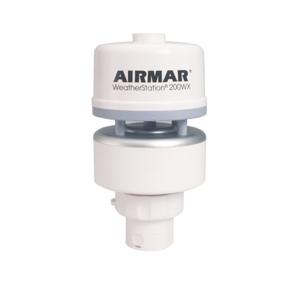
200WX NMEA 0183 / 2000® WeatherStation® - (No Relative Humidity) - RS232 - IPX7
Part #WS-200WX-RS232-IPX7
MFG #44-849-1-01
NOTE: Airmar introduced the 300WX WeatherStation Instruments in April of 2026 to replace the 200WX models. Inventory of 200WX will be in short supply through mid 2026. Please contact our sales team about transitioning to 300WX.
Unmanned Surface Vehicle Monitoring
Reliable monitoring systems such as buoys, and USVs enable operational decision-making based on real-time, site-specific data rather than intuition. The highly changeable conditions at sea make offshore operations particularly challenging. Airmar has worked with many autonomous vehicle and buoy OEMs to develop the WeatherStation model 200WX-IPX7 that meets the operational challenges of this extremely harsh environment.
- Ultrasonic measurement of apparent and dynamic true wind speed and direction
- Barometric pressure
- Air and wind chill temperature
- GPS position, speed over ground, course over ground
- Three-axis, solid-state compass with dynamic stabilization
- Three-axis rate gyro supplies rate-of–turn data
- Three-axis accelerometer for best-in-class pitch and roll information
- Housing rated IPX7 for water-ingress protection
- Data output via a single cable (various lengths available)
- NMEA 0183/ASCII serial data protocol over RS-232 interface
- NMEA 2000 protocol over CAN
- Air Temp Accuracy: ±1.1°C at 20°CAir Temp Range: -40 to 80°C (-40 to 176°F)Air Temp Resolution: 0.1°CBarometric Pressure Accuracy: ±1 hPa at 25°CBarometric Pressure Range: 300 to 1100 hPaBarometric Pressure Resolution: 0.1 hPaCerts And Standards: CE, IPX7, RoHS, IEC61000-4-2, IEC60945, IEC60950_1C, IEC60950_22A, EN55022, EN55024, EN14982Communications Available Hardware Interface: Serial RS232, Serial RS422, CANCommunications Available Protocol: Serial - NMEA 0183, CAN - NMEA 2000Communications Serial Data Transmission Code: ASCIICommunications Serial Output Rate: 1 Hz typical. User selectable. 10 Hz maximum recommendedGPS Position Accuracy: 2.5 m (8’) CEPNote: Cables sold separately unless otherwise specifiedOperating Temp Range: -25 to 55°C (-13 to 131°F)Pitch Roll Accuracy: ±1° in range of ±30°Pitch Roll Measurement Type: MEMSPitch Roll Range: 60°Power Supply Current: <75 mA (<0.9 W) at 12 VDCPower Supply Voltage: 9 to 40 VDCRecommended Use: Marine Mobile or StationaryThree Axis Compass Dynamic Heading Accuracy: 2° dynamic heading accuracyThree Axis Compass Range: 0 to 359.9°Three Axis Compass Static Heading Accuracy: 1° static heading accuracyWeight: 300 g (0.7 lb.)Wind Direction Accuracy: 2.5° RMS @ 20 knotsWind Direction Range: 0° to 359.9°Wind Direction Resolution: 0.1°Wind Speed Accuracy: 2 knots RMS @ 20 knotsWind Speed Calculations: User configurable dampingWind Speed Range: 0 to 40 m/s (0 to 89 MPH)Wind Speed Resolution: 0.1 m/sExterior Color: WhiteHumidity: Optional, Not AvailableWaterproof Rating: IPX7NMEA 2000 LEN: 2Mounting Thread: Standard 1”-14 UNS (3/4” NPT optional)Sensor Connector: 10WSDisplay Connector: Cable RequiredExterior Color: WhiteRefurbished: NoComm Method: NMEA 2000®Country of Origin: USARoHS Compliant: Yes
Serial Data Output Protocol
NMEA 0183 Sentence Structure – Comma Delimited ASCII Format
$GPDTM
GPS Datum Reference
$GPGGA
GPS Fix Data
$GPGLL
Geographic Position—Latitude and Longitude
$GPGSA
GNSS DOP and Active Satellite
$GPGSV
Satellites in View
$GPRMC
Recommended Minimum GNSS
$GPVTG
COG and SOG
$GPZDA
Time and Date
$HCHDG
Heading, Deviation, and Variation
$HCHDT
True Heading
$HCTHS
True Heading and Status
$TIROT
Rate of Turn
$WIMDA
Meteorological Composite
$WIMWD
Wind Direction and Speed
$WIMWV
Wind Speed and Angle
$WIMWR
Relative Wind Direction and Speed
$WIMWT
Theoretical Wind Direction and Speed
$YXXDR
Transducer Measurements
CAN Data Output Protocol
NMEA 2000® Output Message Structure
59392
ISO Acknowledgement
060928
ISO Address Claim
126208
Acknowledge Group Function
126464
PGN List
126992
System Time
126996
Product Information
126998
Configuration Information
127250
Vessel Heading
127251
Rate of Turn
127257
Attitude
127258
Magnetic Variation
129025
Position and Rapid Update
129026
COG and SOG, Rapid Update
129029
GNSS Position Data
129033
Time and Date
129044
Datum
129538
GNSS Control Status
129539
GNSS DOPs
129540
GNSS Sats in View
130306
Wind Data
130310
Environmental Parameters
130311
Environmental Parameters
130312
Temperature
130313
Humidity
130314
Actual Pressure
130323
Meteorological Station Data


Displayed prices are inclusive of all applicable tariff and duty.